Monday, May 2, 2022

TreeTalk in Brussels


Spring is upon us and the trees are greeting us in full bloom. What better way to marvel at the new leaves and flowers serenading Brussels’ streets than to enjoy a guided route of the trees. Inspired by the London-based TreeTalk, we have mapped a walk to enable city-dwellers to discover the urban forest.

TreeTalk is an online mapping tool featuring the location and species of more than 700,000 trees in London. After the user inputs the starting postcode, the software identifies trees and creates a walk assisted by facts and information about each tree. The mission is to inform and explain the benefits of urban trees and green infrastructure. As this software is not (yet) available in Brussels, we decided to create our own mini TreeTalk route.

Before starting the walk, let us first share the root of our love for street trees and why you too should branch out to support urban forests. We know that trees in urban areas are hugely important to those living in the ‘concrete jungle’ for health and wellbeing. Trees also offer a multitude of environmental benefits to communities:
  • Trees hold up to 120kg CO2 during their lifetime and thus purify the city air
  • Trees filter up to 20kg of particulate matter per year such as ozone, sulphur dioxide, etc. and filtering dust, ash, pollen
  • Trees provide shade which acts as air conditioning on an urban scale and prevent the heat island effect
  • In winter, trees form a (wind) screen and thus limit the influence of cold wind and leads to less heating energy consumption
  • Trees are hiding places for animals and insects thus enabling the conservation of urban biodiversity
  • The planting of trees in rows reduces the reverberation of traffic noise of traffic noise on facades
The City of Brussels made a plan to develop and protect its public tree heritage. The objective of the 2020-2030 is to increase the presence of trees in Brussels City and thereby make the city more resilient and pleasant to live in. The drivers of this project are incredibly passionate about urban trees,for example they powerfully state that “For the tree in the urban environment is above all a living being: the vision of a tree as an object, at worst likened to a vulgar piece of urban furniture, must be a thing of the past.” Overall, the initiative aims to increase the public knowledge of street trees and plant trees wherever possible by 2030.


1. Crateaegus laevigata - Hawthorn, Midland

→ Location: Corner of Rue Ernest Solvay
A small dense and bushy tree that is indiscriminately dispersed across many streets in Brussels. It is tolerant of exposed, polluted and damp sites thus an excellent match to an urban context. It is popular amongst wildlife, the birds in particular enjoy the fruits it bears.


2. Acer platanoides - Norway Maple

→ Location: Intersection of small green space
A large tree, often reaching heights above 20m, is widespread in central Europe and eastwards in the Ural Mountains. It is a fast-growing species, able to grow in a wide range of soils and habitat conditions. This species has been used extensively as an ornamental, shade and street-side tree because of its attractiveness, colourful foliage and large, spreading crown, in combination with its tolerance of urban conditions.


3. Aesculus hippocastanum - European Horsechestnut

→ Location: Beside the traffic lights on Rue du Trone
A broad-crowned deciduous tree amongst around ten others of the same species provide both shade and colour along the street. The large leaves are gathered in 5-7 leaflets with both white and red/pink flowers. Although, don’t be tempted by the beauty of these flowers, they are in fact highly poisonous to humans!


4. Fagus sylvatica - European Beech

→ Location: Inside the Parc Leopold
A large tree, it is capable of reaching heights of up to 50m tall and 3m trunk. Beech is widespread across Europe: it can be found from Sicily in the south to Bergen in southern Norway. This particular tree towers above the others in the green corner, its burgundy leaves drape across the park offering a source of shade during the warm days ahead.


5. Carpinus betulus - European Hornbeam

→ Location: Place du Luxembourg
Trimmed to perfection this tree decorates the highly prestigious Place du Luxembourg. It is described as “gnarled and mighty” with egg-shaped, double serrate leaves that are bright green and strong as they offer year-round leaf cover, hence a winter haven for wildlife.


6. Aesculus hippocastanum - European Horsechestnut

→ Location: Back entrance to Parc Leopold
A magnificent tree with a chaotic assembly of branches growing in each and every direction, their presence is seemingly alive. It is unsurprising that its nickname is ‘The Octopus’ given the extravagance of its reach. It is the same species as the tree found at stop three, however this particular one is far more mature and thereby grander - notice the similarities and differences in their appearance.


7. Platanus orientalis - Old World sycamore or Oriental plane

→ Location: To the left of the steps leading back up the hill
This deciduous tree can grow up to 30 m by 30 m at a fast rate. he tree is mainly used for ornamental
purposes, particularly given its characteristic speckled stem and its great tolerance to urban stress. A
fun fact to conclude on is that in Iran, this species is used in traditional medicine!


8. Tilia × Europaea - Common Lime

→ Location: Corner of Rue Goffart entering into Matonge
This tree is a naturally occurring hybrid between Tilia cordata and Tilia platyphyllos. It occurs in the wild in Europe at scattered localities wherever the two parent species are both native.


It was a purposeful decision to have a long stretch between the final two trees, the reason was to show the disparity between a space with an abundance of trees and one where it was lacking. Did you notice this difference, and if so how did the change in tree population impact your walk?

Access to nature should be a universal right. Tree planting in urban contexts enables equality and benefits far beyond the aesthetic and beauty of the green treasures. We hope that this short walk has opened your eyes to the unsuspected dendrological richness of the Brussels Region and you will walk through the streets with more wonder and curiosity.

Written by Alice Sparks, May 2022

Sources:

Conifers.org. 2022. Pinus nigra (schwarzkiefer) description - The Gymnosperm Database. [online] Available at: <https://www.conifers.org/pi/Pinus_nigra.php> [Accessed 2 May 2022].

Brussels.be. 2022. 2020-2030 Tree Plan. [online] Available at: <https://www.brussels.be/2020-2030-tree-plan> [Accessed 2 May 2022].

B.V., B., 2022. Carpinus betulus | TreeEbb | Online tree-finding tool | Ebben Nurseries. [online] Ebben.nl. Available at: <https://www.ebben.nl/en/treeebb/cabetulu-carpinus-betulus/> [Accessed 2 May 2022].

Forest.jrc.ec.europa.eu. 2022. [online] Available at: <https://forest.jrc.ec.europa.eu/media/atlas/Fagus_sylvatica.pdf> [Accessed 2 May 2022].

Pfaf.org. 2022. Platanus orientalis Oriental Plane, Oriental planetree PFAF Plant Database. [online] Available at: <https://pfaf.org/user/Plant.aspx?LatinName=Platanus+orientalis> [Accessed 2 May 2022].

Secretariat, 2022. Platanus orientalis - EUFORGEN European forest genetic resources programme. [online] Euforgen.org. Available at: <http://www.euforgen.org/species/platanus-orientalis/> [Accessed 2 May 2022].

Wood Wide Web. 2022. WOOD WIDE WEB "The octopus". [online] Available at: <https://www.woodwideweb.be/en/atlas/210.html> [Accessed 2 May 2022].


Nature-based Solutions in the New Master Plan of Árborg, Iceland.

By Hugrún Harpa Björnsdóttir

Even though Selfoss is a small town on a European scale, it’s one of the biggest towns in Iceland. With more than 9000 inhabitants and rapidly growing (Statistics Iceland, n.d.a), the municipality of Árborg needed to make another master plan eight years before the old one was outdated. This blog post criticizes the new master plan with Nature-based Solutions in mind. It discusses ideas to enforce NbS in new neighbourhoods in the town. 


The European Commission and IUCN have lately been implementing the concept of Nature-based Solutions (NbS). The main idea is to use natural resources in a sustainable way to respond to environmental changes. NbS tries to secure food and water, respond to floods and implement more greenery. Multiple methods are achievable to adjust NbS in urban areas. Methods like sustainable drainage systems, wetland restoration and increased greening in urban areas. Studies have also shown positive effects between NbS and mental health (Cohen-Shacham, Walters, Janzen, & Maginnis, 2016, European Commission, 2021).


One of the NbS ideas is to increase biodiversity. Biodiversity is essential for humans. It is a significant factor in keeping our ecosystems healthy. Healthy ecosystems help us maintain our soil, purify the air, clean our water, and provide food. Therefore, healthy ecosystems and biodiversity are considered the foundation of our civilization and sustain our economy and society. ( Wilson, Chivian, & Bernstein, n.d.)


The new master plan of the municipality of Árborg mentions the word “biodiversity” once. It states: “The plan should encourage sustainability, protect biodiversity and preservation, and carbon sequestration in soil and vegetation”. Nature-based solutions are never directly mentioned. However, it states the new neighbourhoods should implement sustainable drainage systems. Its main emphasis regarding green areas is on outdoor activities, football fields and playgrounds. It states the importance of playgrounds and dwelling areas in public spaces. The master plan furthermore mentions mixing nature into the urban area (Þorðardottir, Gislason, Sveinsdottir, Olafsson, & Luðviksdottir, 2022). However, it doesn’t develop any ideas concerning that, except the sustainable drainage system. It doesn’t discuss how to implement it. The main emphasis seems to be on the football fields and playgrounds.


A map of Selfoss where the new
neighbourhoods are shown in red
A sustainable drainage system is a step forward. Nonetheless, it is not enough. The master plan can take another step forward by implementing NbS. The plan estimates an additionally 5500 new housing units before 2036 (Þorðardottir, Gislason, Sveinsdottir, Olafsson, & Luðviksdottir, 2022). That is plenty. Especially since the town has more than doubled its population since 1998 (Statistics Iceland, n.d.a, n.d.b). It has been challenging to maintain local infrastructure. The main focus is on developing new parcels for new houses. The population growth needs to slow down for the municipality to concentrate on local infrastructure. That can keep the residents happy. 


Though why not focus on the well-being of the inhabitants instead of building the maximum number of housing units?


It would be interesting to design one of the new neighbourhoods with NbS in mind. The neighbourhood could include a sustainable drainage system. In the middle of the neighbourhood could be a lovely park with a playground and a cafe. The drainage water could create a lake inside the park. The park could be indoors so the locals could enjoy the greenery all year long. It could get inspiration from other indoor gardens, like 550 Madison Garden in New York, designed by Snøhetta, a Norwegian architecture company (Snøhetta, n.d.). It could also be a semi-indoor garden, similar to the Solar Cupola idea, the winning design of the new European Commission research centre in Seville (Crook, 2022), e.g. The garden could escape foul weather all year round. It would use renewable energy as an energy source. Same as the neighbourhood. 


550 Madison Garden in New York


The Solar Cupola
The Solar Cupola

There are ways to keep the number of housing units if the local government would not be pleased about decreasing the potential population due to a park. The new park’s demand for private yards could decline, allowing the neighbourhood to be more compact. Two-floor apartment complexes could be ideal with a rooftop garden rather than a backyard. A private rooftop garden would give people a private garden simultaneously as doing something attractive and different. Something new and different that could work in Iceland.


References: 


Cohen-Shacham, E., Walters, G., Janzen, C., & Maginnis, S. (2016). Nature-based Solutions to     address global societal challenges. Gland, Switzerland: IUCN.

Crook, L. (2022, April 12). BIG models Spanish research centre on Sevillian awnings. From             Dezeen: https://www.dezeen.com/2022/04/12/big-solar-cupola-joint-research-centre-seville/

European Commission. (2021). Evaluating the impact of nature-based solutions. Luxembourg:         European Commission.

Wilson, E., Chivian, E., & Bernstein, A. (n.d.). Why do we need to protect biodiversity? Retrieved     from European Commission: Environment:

    https://ec.europa.eu/environment/nature/biodiversity/intro/index_en.htm

Snøhetta. (n.d.). 550 Madison Garden and Revitalization. Retrieved from Snøhetta:

    https://snohetta.com/projects/487-550-madison-garden-and-revitalization

Statistics Iceland. (n.d.a) Mannfjöldi eftir byggðakjörnum, kyni og aldri. 1 janúar 2001-2021

    [datafile]. Received April 30, 2022.

Statistics Iceland. (n.d.b) Mannfjöldi í einstökum byggðakjörnum og strjábýli eftir landsvæðum ár

    hvert 1889-1990 [data file]. Received April 30, 2022.

Þorðardottir, E. D., Gislason, G., Sveinsdottir, I., Olafsson, E. S., & Luðviksdottir, G. A

    (2022). Aðalskipulag Árborgar 2020-2036: Greinargerð - Tillaga. Selfoss: EFLA.


Green Infrastructure to Prevent Floods: Floodable Parks

By Corina P. Fraile M. and Kathryn Novkov


Climate change has affected water resources in various ways around the world, while some cities have to look for ways to manage it due to shortages, some others have suffered from sea level rise and floods caused by increased downpours. In urban areas, the rainwater runs off the pavement and roofs and, through stormwater drains, ends up in the waterways as polluted stormwater (Melbourne Water, 2017). In recent years, there have been intentions to implement practices that take advantage of water resources in a more efficient way without interrupting its natural cycle and without affecting the ecosystems associated with them. Water Sensitive Urban Design seeks to reduce the harmful effects of stormwater in rivers and creeks as it includes strategies to capture rainwater, with floodable parks and public spaces as one option (Perrozzi and Montiel, 2020).

What are floodable parks?

Floodable parks are designed to be flooded and manage the water they receive in the most efficient way. They help mitigate the risk associated with hydrometeorological events and lower the contamination of bodies of water. They can serve a key role in risk mitigation, acting as a part of a system of quick alert, evacuation plans and monitoring possible floodings. The way they capture and manage water varies from place to place, taking into account the context of each city and its context, but their aim is to recycle rainwater and allow the natural flow of bodies of water. Flooding parks require big underground reservoirs to store the fallen water and use them when required, during times of drought for watering plants, or to slowly drain water after heavy rains in a way that the city system doesn’t overflow. This model of spaces is an innovative referent for the development of public spaces in areas that are prone to suffer from flooding, because they help preserve not only the nearby infrastructures by retaining or redirecting rainwater, but also protect watercourses from urban sprawl by integrating them into the public space system of the city (Perrozzi and Montiel, 2020).

Design for the Chulalongkorn University Centenary Park in Bangkok, Thailand. (Holmes, 2019)


Why are they important?

As climate change has accelerated, flooding has become more common due to changes in the water cycle that have led to an increase in downpours, meaning a lot of heavy rain coming down at once. When rain falls in shorter and more intense downpours, it is more difficult for stormwater drains to contain the water which leads to an increase in flood events. Flooding is very dangerous for cities because it can contaminate drinking water, leave people without electricity, damage property, cause accidents, and in extreme cases can even take lives. (Climate Council, 2022) On top of the plethora of negative consequences of flooding, it is also a very heavy economic burden on cities that can cost them millions of euros (Dobrovičová, Dobrovič, & Dobrovič, 2015). Flood parks like the ones we describe in this blog, can be extremely helpful by keeping most of the water to one area of the city and then absorbing it through its permeable surface and releasing it slowly after the flooding event, which prevents damage to the physical infrastructure of the city. This is obviously one of many solutions there are for flooding and it should not be the only green infrastructure that cities built to minimize flood damage, however, these could potentially be very useful for cities if built in areas that are more prone to flooding such as areas that are lower in elevation (Urban Green Up, 2020 & Climate Action Tool, 2017).

Floodable Park Víctor Jara o Zanjón de la Agua, Santiago, Chile. (Perrozzi & Montiel, 2020)


Some examples

Kirkkojärvi Park, Finland

Kirkkojärvi Park before and after heavy rains (Loci, 2022)
This example is of a flood park located in one of the most populated parts of Finland. The idea was to bring back a lake that was drained decades before. How this works is that there’s now an open field where the lake used to be, and the area around the field was raised so that when it floods, the field is flooded, while the areas around it remain dry and there is once again a “lake”. This not only helps to prevent damage to the infrastructure such as transportation routes around the area, but also creates an aesthetically unique and interesting landscape that raises awareness about flooding and climate change (Loci, 2022).


La Marjal, Spain

Floodable Park La Marjal in Alicante, Spain (CEOE, 2021)
This is the first urban floodable park in Spain and it helps to manage floods caused by heavy rains in Alicante. It has a pond that retains purified water from a purifying plant next to the park and, during periods of rain, the vegetated areas around the pond fill up to reach its maximum capacity (El Independiente, 2019). It has in total 3,6 hectares of flooding area and it can store up to 45.000 m3 of water. In case of heavy rains, it has a monitoring and alert system that lets the authorities know in case of an emergency. The collected water is led to a purifying facility and some of it is used for watering of green spaces. The species planted in the park not only mitigate the effect of floods but they also preserve biodiversity as they serve as refuge for fauna and flora of the region (CEOE, 2021).


Benthemplein, Netherlands

Watersquare Benthemplein in Rotterdam, The Netherlands
(De Urbanisten, n.d.)
This example is of a water square that was built in Rotterdam. The idea was to transform the pavement of this area and create a square that floods with water at times of higher intensity rain and then drains slowly to prevent overflow of the storm drains and sewage systems. This project not only helped decrease the damage from floods to this part of Rotterdam, which is especially important because climate change has particularly increased the number of short but intense downpours in Rotterdam, but it also helped bring together the community. This project was inspired by students who wanted a new social space and asked if this would be possible. Their wishes for better social infrastructure were in line with planner’s wishes for physical infrastructure to mitigate flood damage and so by combining these two wishes they were able to create this flood park. This example goes to show that while floodable parks are a great solution to help prevent flood damage they also usually have many other benefits such as creating a visually aesthetic new physical space that everyone can enjoy (Gemeente Rotterdam, 2014).


References

CEOE. (2021, November 25). La Marjal, un parque urbano inundable diseñado para mitigar los efectos de las lluvias torrenciales. Confederación Española de Organizaciones Empresariales: https://www.ceoe.es/es/ceoe-news/sostenibilidad/la-marjal-un-parque-urbano-inundable-disenado-para-mitigar-los-efectos-de

Climate Action Tool. (2017). Manage floodwater: Create a floodable park or open space. Massachusetts Wildlife Climate Action Tool: https://climateactiontool.org/content/manage-floodwater-create-floodable-park-or-open-space

Climate Council. (2022, March 02). Everything you need to know about floods and climate change. Climate Council: https://www.climatecouncil.org.au/resources/climate-change-floods/

De Urbanisten. (n.d.). Watersquare Benthemplein. De Urbanisten: https://www.urbanisten.nl/work/benthemplein

Dobrovičová, S., Dobrovič, R., & Dobrovič, J. (2015). The Economic Impact of Floods and their Importance in Different Regions of the World with Emphasis on Europe. Procedia Economics and Finance, 34, 649-655. https://doi.org/10.1016/S2212-5671(15)01681-0

El Independiente. (2019, August 25). Así funciona el parque inundable que evitó daños en el día más lluvioso en 160 años. El Independiente: https://www.elindependiente.com/futuro/2019/08/25/asi-funciona-el-parque-inundable-que-evito-danos-en-el-dia-mas-lluvioso-en-160-anos/

Gemeente Rotterdam. (2014). Benthemplein. Gemeente Rotterdam: https://www.rotterdam.nl/wonen-leven/benthemplein/

Holmes, D. (2019, April 19). Chulalongkorn University Centenary Park – green infrastructure for the city of Bangkok. World Landscape Architecture: https://worldlandscapearchitect.com/chulalongkorn-centenary-park-green-infrastructure-for-the-city-of-bangkok/

Loci. (2022). Kirkkojärvi Flood Park. Landezine: https://landezine.com/kirkkojarvi-flood-park/

Melbourne Water. (2017, September 28). Introduction to WSUD. Melbourne Water: https://www.melbournewater.com.au/building-and-works/stormwater-management/introduction-wsud

Perrozzi, A., & Montiel, N. E. (2020, May 1). Parques inundables: el rol del espacio público en la gestión del agua. Transecto: https://transecto.com/2020/05/parques-inundables/

Urban Green Up. (2020). Floodable park. Urban Green Up: https://www.urbangreenup.eu/solutions/floodable-park.kl

Sunday, May 1, 2022

The Antwerp Garden Streets

By Dominiek Mans and Lukas Van Caekenberghe


When imagining a city, a lot of factors can come to mind. When imagining a city compared to the countryside, the main differentiating factor is the built-up area. Cities are the realm of concrete, steel and asphalt whereas the countryside is conceived as a green space with here-and-there some scattered development, for example farms and small houses. This dichotomy between the city and the non-city has come under pressure lately as research into the effects of urban greenery proliferated and has been successfully communicated not only to scientists, but also to citizens.

In Antwerp a group of engaged citizens in 2018 asked the city government permission to redevelop their street by adding more green elements. The city committed to this project and gave funds to support them in their endeavour. Quite quickly, other neighbourhoods followed in their footsteps and the city of Antwerp felt obliged to turn this initially citizen lead project into an urban policy.

The city of Antwerp rolled out their program of ‘garden streets’. The concept of a garden street is quite simple: the idea is that you superimpose a garden on a street. A garden has several characteristics. It has of course green elements, but in an ideal scenario also blue elements and it has the potential to be a place of social interaction. However, these characteristics can also be applied to a street without losing its main purpose, giving access to buildings or being a connector. That’s the concept of a garden street.

One of those streets where this new urban policy has been put into place, is the Lange Ridderstraat. The designers redeveloped this street in quite an innovative manner. Without any vision of how the street could or should look, they went to the citizens and asked them to draw their ideal garden street, keeping in mind the three keywords: green, blue and connection. With this valuable input, the designers went to the drawing board and came up with the following design.


City of Antwerp ©

Important elements in this design are the green garlands connecting the two sides of the streets, greenery against the facades of the houses and planting boxes on the street itself. By adding these elements, the street transforms in a green alley in all dimensions. These green elements can provide shade and cooling, contribute to the biodiversity in the city and are of course more aesthetically pleasing than a sea of concrete. However, there can be no greenery without water. It isn’t only important to water the plants, but also to facilitate water infiltration into the soil because there’s a real danger of drought in Belgium. The watering system in the street is quite ingenious. When it rains, the water from the roofs gets collected in a couple of water reservoirs along the street. These are connected to old fashioned water pumps where residents can use them to water the plants. The pumped water flows into a small river and then into the planted areas. When the reservoir is full, the excess water is carried to the street via an overflow pipe, which allows for normal infiltration. Infiltration of rainwater is further maximised by using porous materials and reducing the amount of hard surfaces in general in the street.

The vision on a plan can differ quite strongly with the reality. That’s why the plan was tested for two months, using paint and temporary street furniture. Afterwards, citizens could evaluate the new condition of the street. The main adjustments had to do with the traffic function of the street. By optimising the placement of the hard materials, the street became easier to navigate as a driver or cyclist. Owing to the fact that the garden street is still a street!


The result is a cosy street in the centre of Antwerp with a calm atmosphere. The citizens are mainly satisfied with the integration of the blue infrastructure in the street. The small river gives children the ideal opportunity to go out and play. The green infrastructure is well maintained. It has been done partly by the city’s green services, but also by the residents itself. During the design phase, the residents were encouraged to choose what kind of plants they wanted in front of their house They were also asked if they wanted to maintain the plants. Ten families responded they would like to do so. The other citizens preferred that the city to take care of it. Taking care of the plants can be a family or neighbourhood activity, that contributes to the social aspect of the project. The aims weren’t only ‘green and blue’, but also to make new connections. The old-fashioned water pumps are also there to facilitate these connections between citizens

City of Antwerp ©

 On a more technical note, since the redevelopment of the street in June 2021, fewer cars passed through the street and more pedestrians and cyclists were spotted. The hydrographical adjustments in the street are also successful. The system of reservoirs, pumps, a little river and eventually a sewer maximised the infiltration of rainwater into the soil. Until now (may 2022) the sewers have seen not a single drop of water! That’s impressive and shows the potential to renew the groundwater table in Belgium.

‘What’s next?’, you might ask. The garden street ‘Lange Ridderstraat’ was part of a pilot project throughout the city. The other garden streets also received a positive evaluation and the city decided to continue the project under the motto ‘Antwerp breaks free’. The city government contacted all residents of the streets in the municipality who would be eligible to transform their street into a garden street. The main conditions are having a low number of cars going through the street, and not having seen a street-redesign recently. From this longlist, another 17 streets were chosen on the basis of the enthusiasm of the citizens of those streets. That way the citizens are again at the centre and basis of the redesign of their neighbourhood.


Jardins Participatifs d'Etterbeek

By Erwan Guenec and Fábio Gouveia

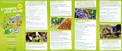
   The Jardins Participatifs d'Etterbeek seek to achieve environmental justice goals and provide several ecosystem services in a participatory manner. The initiative is a joint collaboration between the Etterbeek municipality, residents, and a number of associations, it seeks to provide a wide range of services that  respond to the social and environmental needs of the community. Its programme is composed of spaces for organic farming, learning, natural ecosystems, leisure, and composting. 

The project saw three successive waves of development since its 2010 inauguration. The original 2700 m² of garden stretching alongside the railway, hosting multiple types of green spaces, activities and workshops, was later on extended to include an additional 1000 m². This new space was fully dedicated to organic agriculture and offering professional training courses to promote urban farming. With the coordination of both the Sustainable Environmental Development Department of the municipality and its CPAS (Public Centre for Social Action), the project ‘Légumes Bio d'Etterbeek’ was founded. A social grocery shop was created to sell vegetables cultivated in the garden at a discount for the socially disadvantaged community living nearby. The last phase of the project offered an adapted space within a part of the garden which aims to be more inclusive to people with a handicap. 

Social and environmental associations, such as Natagora, for instance, play a key role within the project, since they manage some of the plots, but also run activities and training (e.g., in beekeeping, composting, grafting, etc.), as well as managing ecosystems or promoting people’s interest in nature. 

In order to get a better sense of the actual functioning of the gardens, as well as the impact it has on the neighbourhood, we spoke to one of its users, who kindly agreed to guide us through the space and talk about her experience. We were curious to know more about the perceived benefits from the participating gardeners, their difficulties, and the relationship between them, the associations, and the Etterbeek commune.

We were led first through the publicly accessible section, a narrow park with a few benches facing the railway, which is open to the general public during weekdays, even functioning on an extended schedule during the summer months. Since the park sits on the side of a steep slope, which is left in a fairly wild condition, it was quite apparent that a large variety of plants, birds, and insects were all concentrated in this small space. At the end of the path, we reached a gate, which our guide unlocked, so we could enter the areas reserved to members and accompanying persons.

The first of these areas is devoted to the communal plots and other shared utilities. This is the section where our guide was allotted her planter bed, which she had shared with other members for the last seven years. In the case of the collective plots, the yield is rather symbolic due to their small size. Nevertheless, the participants seem to remain actively engaged in the upkeep of the parcels, organising themselves to delegate tasks and cooperating to maintain the gardens in good condition. In conversation with our interviewee, she confirmed the importance of the social aspect of the project, highlighting the real sense of community she experienced by partaking in the activities.

The COVID-19 pandemic and subsequent containment measures exposed the degree of inequality in terms of access to green spaces and safe places to socialise in many cities. But, for the users of the Jardins Participatifs and the residents of the adjacent social housing units, these issues were not felt to such a great extent, as the gardens provided a green space where people could still meet. Members of the community could keep in touch and coordinate access to the gardens, attenuating many of the ails felt by large parts of the population who found themselves isolated from social contact and proximity to nature. The mental health benefits should not be underestimated, especially since some of the users are elderly and/or vulnerable individuals, who would otherwise be alone, including a case described by our guide, of a member with mental health issues, to whom the community has become a crucial support network.

Beyond the communal planters section, follows an area where each plot is individually attributed, then various rows of different fruit trees, where our escort proudly taught us how to cut certain branches to allow more fruit to grow. It was clear from her description that the gardens were a place of learning – the associations bring their expertise and share it through trainings, which anyone can enrol in, but the gardeners also exchange the knowledge they acquire amongst themselves and with visitors on a regular basis.


We then made our way to the end of the section. Here another gate separates the part which is kept by Natagora as a small-scale biodiversity reserve. Just before the gate, a beehive and a pond seek to encourage and foster the presence of pollinating insects and other animals.


We made our way back, reflecting on the benefits and challenges of the project. Some of the equipment was visibly in need of maintenance, such as a rainwater collection system, or a few of the planters. Rain had also caused small landslides on the slope and the current retaining walls clearly required upgrading. Furthermore, the tool shed had become too small to adequately shelter all the materials and an expansion was planned. When we asked about who was to solve these issues, we were told the municipality would be taking care of it.  We might have assumed there was some neglect by the part of the local government, but we were made aware not only that workers from the municipality enable the functioning of the gardens by doing regular maintenance, and supplying water, mulch, etc., but also that staff from the sustainable development office visit the site on a weekly basis, coordinating with members and assessing their needs. The major issue seems to be, not the lack of engagement by the authorities directly responsible for the project, but rather budgetary constraints at a higher level.

Considering the number of ecosystem services that are generated by the presence of these community gardens (related to biodiversity, air quality, waste management, health, culture, community, etc.), it seems like the Etterbeek municipality could afford to invest further into such programmes. In creating a space that is “just green enough”, they seem to have struck a balance in creating socially and environmentally beneficial green infrastructure, without immediately perceivable adverse effects sometimes associated with such programs.


References


Environment.brussel (n.d), Jardins participatifs d'Etterbeek.

https://environnement.brussels/fiche/jardins-participatifs-detterbeek 


Etterbeek.durable (2022), Etterbeek, côté nature.

https://etterbeek.brussels/sites/default/files/2022-04/20220309_flyer_etterbeek_cote_nature_cultiver_en_ville_web_fr.pdf 


GoodFood.brussel (n.d), Légumes Bio d'Etterbeek.

https://goodfood.brussels/fr/contributions/legumes-bio-detterbeek 


Houbart, A. (2018), Les Jardins participatifs: Natagora Bruxelles participe à ce beau projet à Etterbeek! Natagora Bruxelles. 

https://bruxelles.natagora.be/nos-actions/gestion-et-protection/les-jardins-participatifs

Manganelli, A. (2013). Nurturing urban development. The impact of urban agriculture in Brussels capital region.
https://www.politesi.polimi.it/bitstream/10589/84543/1/Manganelli%20tesi%20def.pdf 


GREEN TRAMWAY TRACKS – A FLAWLESS NATURE-BASED SOLUTION FOR URBAN GREENING?

  By Jakub Osmański   Although they had been known and used for over 100 years, the interest in green tram tracks and their application ...